Wednesday, June 1, 2011

Mt. Moosilauke

I was invited to go camping with the Champ and some aquaintences of his.  It was my first camping trip of the season, and I was pleased that I was able to break out my camping gear and shake the rust off.  The place was the Lost River Valley Campground in North Woodstock, NH.  It is located about 6 miles off of I93 on rt112 otherwise known as the infamous Kancamagus Highway.  But, you head west from I93 rather than east, so therefore it is not known as the Kancamagus Highway but simply rt112 west.


It was a strange arrival because I didn't  know anybody except for the champ of course.  He gave some directions and I ending up having to trek in a little bit with my gear to get to the site.  There I found about 10 folks spread out over 5 camp sites.  A central site was determined and that was where everybody hung out.  


It was a raucous, New Hampshire crowd and they had all the amenities of camping; large kitchen sets and grills, nice fold up lawn chairs and an array of various flags hung about.


I was recently told by a friend that hanging flags around the campsite is not for patriotism, or an enthusiasm to display regalia, but a way to keep pests away from the campsite, specifically hippies.


We ate meat.


We played a weird game called ladder golf...ever hear of it?
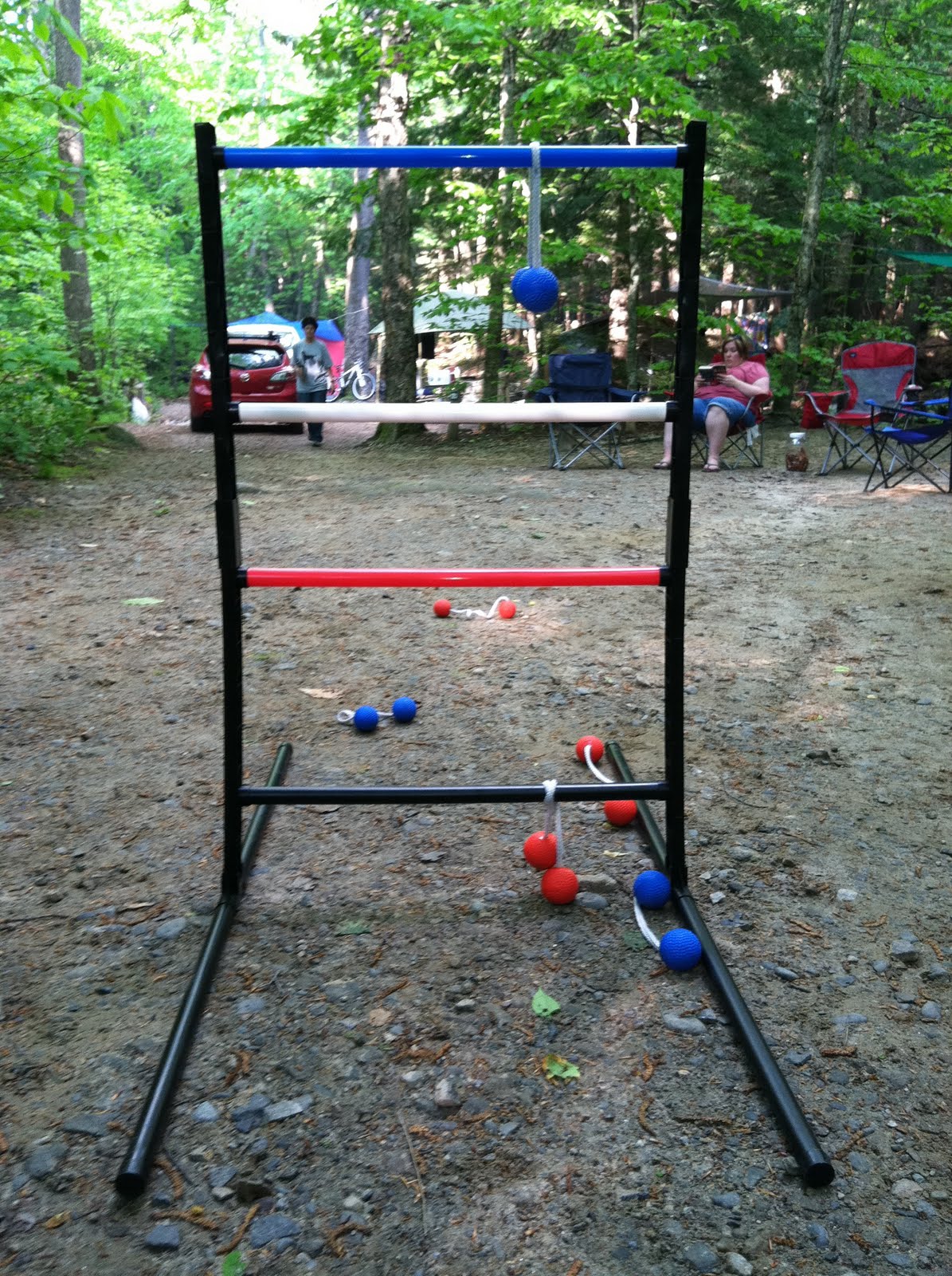


We had a great nights camp, and I even broke out my guitar for awhile. That was an ordeal onto itself and I faced some adversity.  All in all Barry and Greg were great to us and we had an incredible meal and a fun night courtesy of them.


The next morning it was down to business.


As it turned out the campsite was about 2 miles down rt. 112 and the Appalachian Trail, the trail that I intend to take on the the Bike Hike #5. It was a no brainer to go climb Mt. Moosilauke and use the Beaver Brooke Trail.  With a good nights sleep and an early start, I made good time getting to the trail.


Mt. Moosilauke is the southwestern most 4,000ft'er in the White Mountains.  At 4,802 it features an exposed summit with often very windy conditions.  The Appalachian Trail runs right over it.  The mountain and trails running over and around it are owned and maintained by the Dartmouth Outing Club (the oldest outing club in the United States) and as such the trails are always in great condition.  For through-hikers it does have a lodge, The Moosilauke Ravine Lodge.  This mountain along with Mt. Chicorua is rich with native american history.  The name "Moosilauke" means 'bald' (moosi) 'place' (auke).  Being close to and maintained in part by faculties of Dartmouth College, it is a very popular mountain.  Although, I really don't mind seeing all the lovely, ivy league girls that frequent the mountain.


As far as hiking the mountain, you really couldn't ask for a better mountain.  It really has everything you want; back-country campsites (AT shelter - Beaver Brooke Shelter), regular pay campsites, a lodge, and many trails ranging in various difficulties.  I have climbed this mountain twice before and both times taken the Carriage Road trail, which is a very gradual and moderate route up the mountain.  Being on the AT, it also has some really tough routes up.  When you see a sign like this you know your getting your ass kicked.


And it was extremely tough.  Within .5 miles I was climbing up a steep slope right along Beaver Brooke with the cascades getting more intense as I ascended.  There were several very steep sections where I had to climb up wooden and steel steps drilled into the a rock face.  One section in particular required a climp up (and down latter!) a rock face only with steel ladders about 150ft.


My route was the Beaver Brooke trail to the Asquam Ridge trail to the Benton trail and leading up to the summit.


I always have to get a bit nostalgic about the AT.  It is sort of a pipe dream if mine to do a through-hike.  I admire the scale of the trail and the efforts that were taken to construct it.  I have been on many sections of it in Maine and New Hampshire and it always has some of the best and most challenging trails.


Beaver Brooke was really tough but once up on the ridge line on the Asquam Ridge trail, the going was a bit easier.  There were no views to be had due to the weather.  But once I got up to the Benton trail .4miles from the summit, I was awarded with some nice alpine scenery.


Since Moosilauke essentially means "bald place", you can imagine that it has some nice alpine sections.  The area around the summit is completely exposed above tree line and does have some amazing panoramic views.  I only caught some scattered views as the early morning fog was still blowing about the summit.


I have stated that I love trail signs and Mooseilauke has one of the most beautiful summit trail signs.


A kind gentlemen was willing to snap a shot of me at the summit.

Sunday, May 8, 2011

Mt. Tripyramid (North Peak)


With a free Saturday to myself and no real plan in place, I once again found myself making the drive up to the Kancamagus Highway for a short day hike.  I choose Mt. Tripyramid's North Peak.  The trail was the Pine Bend Brooke trail.  The trailhead was directly off of the road, no pull in parking area, which left me a bit nervous about leaving my car in this position.  I was assured that this is common practice up on the Kancamagus by a hiker I encountered on the way down the mountain. The first two miles of the trail were extremely well blazed in yellow and relatively flat and moderate.


At about 2 miles in, the trail took a turn directly up the stream bed and the slope of the mountain.  I've never encountered this before. Unfortunetly, the pic above dosen't illustrate that very well.  It turned out to be pretty steep the rest of the way up.  Again, much like Chocorua, the upper sections of the trail were very snowy and icy, causing me to go to my crampons for the rest of the trip up the mountain.  I could have used snow shoes in some sections, and I even saw a couple hikers with them on.


Although the Pine Bend Brooke trail is beautiful and challenging, it doesn't offer many views at all.  One doesn't even catch a glimpse of North Tripyramid until you hit the top of the ridge running from Scaur Peak up to the north peak.  I did manage, however, to snap this particularly nice shot of Mt. Washington that closely resembles a painting with the many shades of colors visible in the clouds and haze.  Many 4,000ft's in the White Mountains do not have great views if any at all. Many, like North Tripyramid, are wooded summits.  This makes for some great quiet and serene hiking which I love.  I did see a few folks, but compared to Mt. Chocorua it is much less hiked.


The wooded summit of Mt. Tripyramid's north peak...


Trails off of the Kancamagus Highway are going to be somewhat popular, but I do have the feeling that this particular section is not.  It's such a great little section to hike.  For the hardcore day hiker Mt. Tripyramid has two other peaks, South and Middle that can be obtained easily in one day.  I was told that the col between North and Middle peaks was in especially bad condition due to the soft snow and ice.  An interesting fact is that although the South Peak stands at 4,100ft it is not listed on New Hampshire's 4,000 footer list because of the technicality that distinguishes whether a 4,000 footer is a true summit.  That being that it is less than 200ft above the col on the ridge from Middle Tripyramid.  The Middle peak is listed on the 4,000 footer list at 4,140ft.


For some reason I'm obsessed with photographing trail signs....


Again, the beautiful Sandwich Range Wilderness.  It features a handful of rugged steep peaks barely over 4,000ft, great history, accessibility via main routes, and it less hiked than most regions in the White Mountains. It makes for some great hiking for folks who like to be alone.  Like me.


Of course no good day hike is complete without stopping for a few frosty ones right off of rt.16 at the Whittier House in West Ossipee. This place has kick ass food, good beer and a wooden bear.


Thursday, May 5, 2011

Mt. Chocorua ("shuh-cor'-wuh")


What happened to the 5,000ft club?, your saying right now.  The answer is, I had the old ball and chain (my lovely fiancee) with me on this one.


I've been up Mt. Chocorua before via the Piper trail, but it is such a great hike, and relatively short and moderate. It's also in the southern White Mountains, in the Sandwich range, making it a bit shorter of a drive to get to from Massachusetts.  Standing at 3,490ft, it's the eastern most peak of the range.  It does feel like a 4,000ft'er though.


It was my girl's birthday weekend and she wanted a special northern getaway type vacation.  She likes to hike a bit too, so she agreed to do an "easy" one.  After, we were to max and relax at an inn and spa in Jackson, NH.


An interesting thing happened when arriving at the trailhead just off the Kancamagus highway.  The trail we wanted to use, the Champney Brooke trail, had been blocked off due to a small bridge being damaged. The stream was just alive enough to make it a tough crossing.  We did end up going over the bridge after all, being the rebels that we are.


Mt. Chocorua is slowly becoming one of my favorite mountains.  It's rich native American history and beautiful location make it a really special mountain.  The view from Chocorua Lake is especially beautiful. 


The trail was very wet and mucky, and once we got up into some elevation we hit some snow and, more notably, some heavy ice.  I brought some crampons and my girl brought some microspikes, but she forgot them in the car. To be honest I really didn't think we'd need them and was surprised by the adverse conditions.  Being the gentlemen that I am, I outfitted her with the crampons and took chances bare-boot. It proved to be a good decision because once up above 3,000ft the ice really became a factor.  Unfortunately I didn't take any pics of the rather rough conditions high up.  Of course, nearing the summit the snow had been melted by the exposed sunlight.


Mt. Chocorua is unmistakable in the skyline.  It's conned summit has a very distinct look.  Driving up rt.16 it is the first major, noticeable peak. It is technically in the town of Tamworth, NH, but the lake is in a cute little village called Chocorua Village.  Surprisingly exposed, the last .5mi or so involves a bit of scrambling, and is certainly a fun little climb.  The summit is a very small area of rock that probably can accommodate 7 people at most.  The views are excellent...completely exposed and panoramic.


The one glaring downside to Chocorua is that it's so darned popular for many of the reasons I've stated above.  Both times I've been to the summit it's been annoyingly crowded.  Overall, the views are some of the best around.


On the descent we decided to take a little side trail called the Champney Falls trail.  It passed by some impressive falls as well as an impressive group with similar tee-shirts out for a day hike of Chocorua with the similar ideas we'd had..."We'll go and climb an easy mountain today. How about Mt. Chocorua."  I learned another valuable lesson. Even in a nice springy early May day, up in the mountains you'll find some adverse conditions and you'd better be prepared for them.  We guessed the large group with sneakers and sandals won't even sniff the summit.


The falls, by the way, we beautiful.


Next post: Mt. Tripyrimad (North Peak)

Wednesday, May 4, 2011

Mt. Lafayette


I have long planned on 2011 being a big hiking year, enough to match my first year hiking of which I have yet to duplicate...that was 2007.  

It's all about the preparation for the 5th annual "Big Hike."  To train for this 3rd attempt at the Mahousac region in NH and ME I have decided that I will attempt a run at all the 5,000ft'ers in NH in spring and early summer leading up to July 4th weekend.  To start with, I attempted a summit of Mt. Lafayette on an unusually warm day in early February.


Mt. Lafayette and the "Franconias" are just north of Lincoln, NH in Franconia Notch State Park.  It's a three headed beast with Mt. Lafayette standing at 5,260ft.  The other two peaks are Mt. Lincoln at 5,089ft and Little Haystack Mt. at 4,760.  This day I climbed just Mt. Lafayette (I had already been up Lincoln and Lil' Haystack) via the Old Bridle Path, an insanely popular trail that provides the quickest way to the summit. Here's an early pic of things to come on my hike. The Franconias are unmistakable in appearance.


The first half of the hike was easy.  I brought some snowshoes and crampons, but didn't need them as the snow was so packed down it actually made it an easier hike due to not having to negotiate rocks, roots and the such.  It many ways it is a very long hike.  Once you get up to the 4,000ft range, as you can see by the pic above, there is still a very long ways to go over the ridge line.  Tree line is at about 4,700.


Like I said it was an unusual winter day.  It was 45 by 10:00am, hazy, scattered sun and clouds...beautiful.


The trail conditions were really good.  The packed down snow made it really easy.  Although once at high elevation the snow got a bit deeper and harder to negotiate, prompting me to pull out my crampons.


The summit in view just after Greenleaf Hut.


So, I learn stuff every time I go out for a trip.  Once I hit tree line and into some alpine type stuff the wind picked up and it got cold.  Although prepared as far as gear in my pack, I fumbled around putting it on in the wind.  Lesson learned is prepare for the alpine zones and the summit ahead of time.

Dig it...


I got off the summit just as the clouds started to cover that sucker.  I chilled out at Greenleaf hut, had a butt, and headed down.


That was the second time I climbed Mt. Lafayette.